Ponte Segade (Sor River): What to See, How to Get There & Travel Tips
A practical guide to visiting Ponte Segade, one of the most peaceful and unexpected corners of northern Galicia, on the Sor River trail.
Best time of day
Ponte Segade works especially well in the middle of the day, when the light filters through the trees and the setting is best enjoyed. In summer it's also a perfect place to cool off or stop for a quiet break.
The essentials
How to visit Ponte Segade (Sor River) as part of a route?
For us, Ponte Segade is the best place to start the day on a route through the north. It introduces the inland landscape before opening up towards the coast, creating a clear contrast between forest, river and sea.
**Circular route: Río Sor, Bares & Loiba Cliffs** Río Sor (Ponte Segade) → Estaca de Bares → Porto de Bares → Loiba Cliffs → Ortigueira **Practical info:** Location: Sor River (Mañón). Duration: Short-to-medium stop (30–60 min, easy to extend). Conditions: Well-prepared natural setting. Recommended: Short walk + break. Parking: Generous, including space for campervans. **How to get there:** By local road from O Barqueiro or from the interior of Mañón. Access is easy and well signposted.
See Route between the Ortegal Geopark and the Wild NorthIf you're getting hungry…
There are several options you can find online, but we particularly like:
Authentic Galician seafood in Porto de Bares
If you're thinking of doing something special:
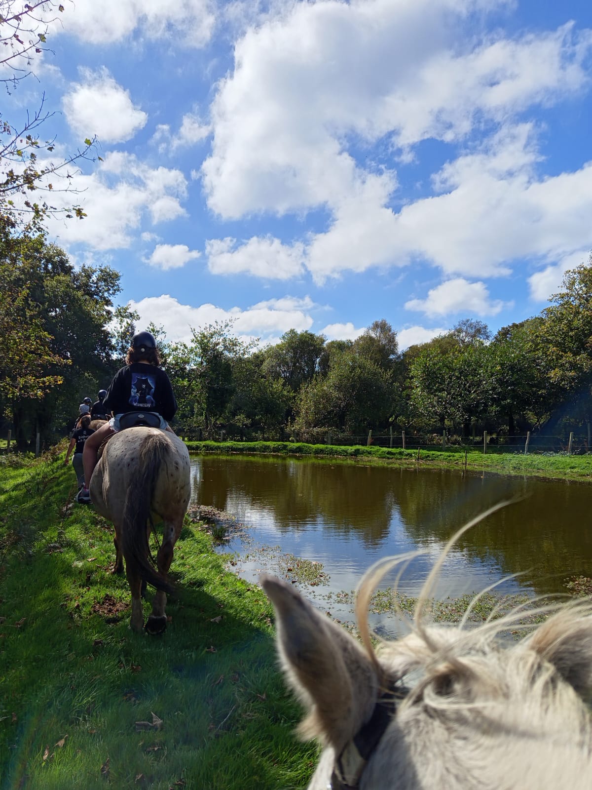
Horseback rides in the heart of nature in northern Galicia. No rush, no crowds, and calm horses raised and trained in a natural way.
Before you go
Come and live Ortegal with us
Granja Labrada is your base for exploring the area. Stay the night, add a horse-riding experience, or combine everything into a single plan.
 Most requested
Unique experiences with horses
Add a horse-riding experience to your stay in Ortegal. Our trails start from the farm itself and are open to all levels and ages.
View activities →
Stay at Granja Labrada
A restored stone house in a tiny hamlet, surrounded by horses and nature. A quiet base from which to explore Ortegal calmly.
View accommodation →
Plans with a discount
Accommodation, horses, breakfast and the surroundings in a single rounded plan — designed to be enjoyed at a slow pace, or as we say here, «A Modiño».
View plans →Project co-financed by:

Coastal enhancement project (TU503F) co-financed by the European Union – NextGenerationEU.
